Upper Level System Producing Strong Afternoon Storms
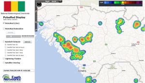
19 September 2013, 14:00 UTC: An upper level system tracking along the ITCZ toward the coast of Guinea the last two days has been generating very strong storms early this afternoon. Our simulated radar shows siginificant rainfall is occuring and tracking slowly toward the coast.
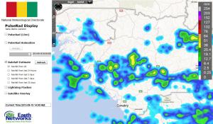
Storms have produced over 1″ of rain in a short period of time. Total rainfall so far this afternoon is shown in the image below. Areas to the west of these storms can anticipate similar amounts.
These storms produced wind gusts over 80 km/hr in Labe and thousands of lightning strokes per hour. The image below shows peak wind gusts across the region and a plot of lightning detected by our network in just one hour.


